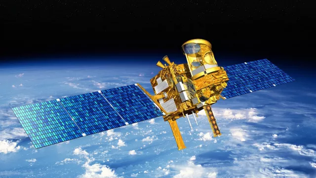
Launched in 2011, the French-Indian Megha-Tropiques satellite pointed its instruments at the turbulent atmosphere of the intertropical belt, where the most extreme weather phenomena on the planet—cyclones, monsoons, etc.—are formed.
Key information
Key figures
- 1,000 kg: satellite mass
- 4 instruments
- 10-km horizontal resolution for convective cells and water vapour
- 40-km horizontal resolution for radiation budget and other cloud parameters
Key milestones
- March 2023: End of mission
- August 2016: Mission extended four years
- 23 May 2014: Mission extended two years
- 12 October 2011: Megha-Tropiques launched by PSLV
- 2004: Start of development of Megha-Tropiques project
Project in brief
Megha-Tropiques was dedicated to studying the water cycle and energy exchanges in the tropical belt, key to understanding Earth’s climate and energy budget. The mission has thus helped scientists to gain new insights into how water vapour is transported and distributed in the atmosphere, the impacts this has on the energy budget in this region of the globe and the formation and development of tropical convective systems, with a view to better characterizing climate change. The goal was to better predict extreme tropical weather events and protect populations.
In more than 10 years, the mission accumulated a wealth of remarkable science data. In fact, to meet user demand, it was extended several times beyond its initial three-year nominal lifetime, thanks to the excellent health of the satellite and its SAPHIR and ScaRaB instruments. Megha-Tropiques was part of the constellation of satellites participating in the Global Precipitation Measurement (GPM) mission pursued jointly by NASA, JAXA, ISRO and CNES.
The MADRAS imaging radiometer, designed by ISRO and CNES, collected data on rainfall, water vapour and clouds; the SAPHIR sounding radiometer, developed by CNES, measured the vertical humidity profile; and the ScaRaB wide-band radiometer, also developed by CNES, measured Earth’s radiation budget.
CNES’s role
CNES was prime contractor leading development of the SAPHIR and ScaRaB instruments and jointly responsible with ISRO for development of the MADRAS instrument. It also worked alongside ISRO to switch on the instruments at the start of the mission.
CNES’s Megha-Tropiques expertise centre provided technical expertise for the ScaRaB, SAPHIR and MADRAS instruments. This centre received raw data from the instruments and kept a check on technological parameters within the scope of the agency’s contribution.
CNES performed in-orbit commissioning of the ScaRaB, SAPHIR and MADRAS instruments.
CNES collected part of Megha-Tropiques data through its ground station in Kourou, French Guiana.
Contacts
Atmospheric Physics & Meteorology subject matter expert
Adrien Deschamps
E-mail: adrien.deschamps at cnes.fr


