ODYSEA (Ocean DYnamics and Surface Exchange with the Atmosphere) is a French-U.S. mission proposed by the Jet Propulsion Laboratory (JPL) and CNES for NASA’s Earth System Explorers Announcement of Opportunity (AO).
ODYSEA’s objective is to study ocean surface winds and currents at fine scale. The mission was defined as a priority at CNES’s 2019 Science Survey Seminar.
Key information
| Mission | Simultaneous observation of ocean surface winds and marine currents |
|---|---|
| Domain | Earth observation |
| Launch date | Scheduled 2030 |
| Partners | NASA/JPL |
| Where | Sun-synchronous Earth orbit at altitude of 600 km |
| Lifetime | 3 years |
| Status | In development (Phase A) |
Key figures
- 80% of Earth’s surface surveyed in one day
- 5 km x 5 km spatial resolution out to 3 km from shore
- 50 cm/s measurement precision for surface current velocity for winds above 7.5 m/s
- 1.5 m/s measurement precision for wind speed for winds from 5 to 20 m/s
Key milestones
- 2030 timeframe: Launch of ODYSEA satellite
- November 2025: If the ODYSEA mission concept is selected by NASA as one of the two ESE missions, it will progress to phases B, C and D
- 8 May 2024: ODYSEA selected by NASA as one of four proposals for ESE AO and transitions to phase A1 nine-month concept study
- 31 July 2023: JPL/CNES submit proposal to NASA under its Earth System Explorers (ESE) Announcement of Opportunity (AO)
- 1 January 2023: Project progresses to Phase A0
Project in brief
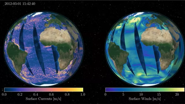
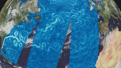
The ODYSEA satellite will enable scientists to observe ocean surface winds and currents simultaneously for the first time ever. Where previous missions have rendered these data from measurements acquired over several days, ODYSEA will collect surface current and wind data simultaneously.
To do this, ODYSEA will employ the AVRI instrument (Air-sea Velocity Radar Instrument), a wide-swath rotating Doppler scatterometer operating in Ka band (35 GHz) capable of estimating winds and currents by measuring phase differences between two consecutive sent and received signals, as well as the strength of the signal backscattered to the satellite. This radar instrument will offer a pixel resolution of 5 km by 5 km. Due to the rotation of the payload module, AVRI will acquire measurements in an uninterrupted spiral. As it advances along its orbit, the satellite will measure the 5-km-by-5-km vignettes (front or back) from a different viewing angle, thanks to the overlap of each measurement spiral. The size of the swath and orbit will enable the daily coverage required by the mission's objective.
The mission’s science goals are to:
- Gain new insights into ocean-atmosphere climate forecast and projections and improve climate projections
- Understand how current-wind coupling affects the main ocean currents, local and remote winds, and storm tracks
- Understand how surface currents exchange and transport energy
- Develop a deeper understanding of climate
The mission’s societal goals are:
- For ocean forecasting, to improve ecosystem and fisheries management, sea search and rescue, ship routing and monitoring of marine pollution
- For weather forecasting, to strengthen extreme wind/wave and coastal risk early-warning systems
- And to improve weather and ocean forecasts to protect lives, property and economic prosperity
CNES’s role
CNES is responsible for delivering the microwave radar subsystem, the gyroscope and processing electronics. It is in charge of integration and testing of the radar electronics and will be lending support to JPL throughout complete instrument and satellite testing. The agency is also supplying the mission centre and tasked with processing instrument data.
CNES and JPL will jointly define and develop processing algorithms.
JPL is supplying the spacecraft bus and the payload’s structure, antenna and power tube. It is also in charge of instrument and satellite assembly, integration and testing (AIT). It is supplying the satellite control centre and launch services.
Contacts
Project Leader
Magali Tello
E-mail: magali.tello at cnes.fr
Oceans subject matter expert
Yannice Faugère
E-mail: yannice.faugere at cnes.fr


