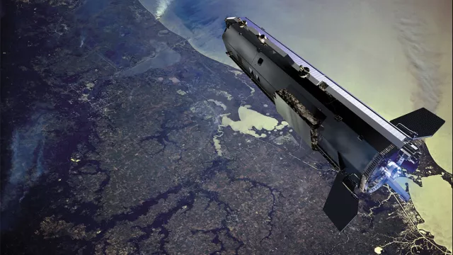
From 2009 to 2013, the GOCE satellite mapped Earth’s gravity field with unequalled spatial resolution and accuracy.
Key information
| Mission | Study Earth’s gravity field |
|---|---|
| Domain | Earth observation |
| Launch date | 17 March 2009 |
| Partners | ESA |
| Where | Near-circular orbit at altitude of around 260 km |
| Lifetime | End of mission: 21 October 2013 |
| Status | Completed |
Key figures
- 1,100 kg: satellite mass
- 2 cm cumulative geoid error and 1 mGal (=10-5 m/s2) precision when measuring gravity field at spatial resolution of 100 km
- 3 instruments: gradiometer, GPS, drag compensation
Key milestones
- 10 to 11 November 2013: End and deorbiting of GOCE mission
- 17 March 2009: GOCE satellite launched by Rockot
- 17 March 2002: Two GRACE satellites launched, complementary to GOCE
- 1999: ESA selects GOCE mission for its Earth Explorer programme
Project in brief
For more than four years, the European GOCE satellite (Gravity field and steady-state Ocean Circulation Explorer) circled Earth at around 260 kilometres. To compensate for the effects of atmospheric drag in this very low orbit, the satellite was equipped with ion thrusters, without which it would have fallen back to Earth in a matter of months.
Why such a low orbit? Because the gravity field’s attraction is stronger the closer we get to the centre of the Earth, making it easier to measure the tiny spatial variations caused for example by ocean trenches, mountains or movements inside the planet’s mantle.
GOCE’s measurements have enabled scientists to map Earth’s geoid with unprecedented accuracy at a spatial resolution of 100 kilometres. The geoid is the surface of an ideal global ocean in the absence of tides and currents, shaped only by gravity. It serves as a reference surface for numerous other missions and scientific studies. For example, GOCE data are widely used to determine mean sea surface height, thermohaline circulation and ice thickness, and therefore to better understand climate change and its impacts. They are also of great value in geophysics.
GOCE complemented the GRACE mission (Gravity Recovery And Climate Experiment), which between 2002 and 2017 observed temporal variations in Earth’s gravity field due notably to tides, ocean currents and changes in polar ice cover, at a lower resolution of around 200 kilometres.
CNES’s role
GOCE was the first Earth Explorer mission selected by ESA, in 1999. CNES’s space geodesy team is part of the European consortium tasked with generating science and operational products from GOCE data.
Contacts
Internal Geophysics, Geodynamics and Geodesy subject matter expert
Felix Perosanz
E-mail: felix.perosanz at cnes.fr


