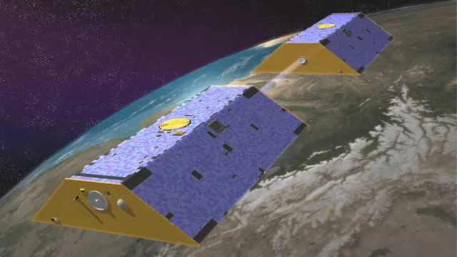
From 2002 to 2017, the two GRACE satellites trailed one another in the same 450-km orbit, where changes in the distance between them revealed spatial and temporal fluctuations in Earth’s gravity field. Since 2018, the two GRACE-FO satellites are pursuing the same mission.
Key information
Key figures
- 500 kg: mass of each GRACE satellite
- 2 co-orbiting satellites
- 4 instruments on each satellite measuring distance between them, accelerometer, star tracker, GPS
- 100 x improvement in accuracy of new gravity maps generated by GRACE
Key milestones
- 22 May 2018: Two GRACE-FO satellites launched by Falcon 9
- October 2017: End of GRACE mission
- 17 March 2009: Launch of GOCE satellite, complementing GRACE mission
- 17 March 2002: Launch of two GRACE satellites by Rockot
Project in brief
GRACE (Gravity Recovery And Climate Experiment) are joint missions of the U.S. and German space agencies, NASA and DLR, based on two twin satellites permanently connected by a microwave link enabling the distance between them to be determined with micrometre accuracy—roughly the thickness of a human hair. This separation distance (150 to 300 kilometres), which can be adjusted by manoeuvring the satellites, varies by a few tens of metres every time they pass over fluctuations in Earth’s gravity field.
By measuring these changes in distance between the two satellites continuously, scientists are able to compile detailed maps of Earth’s gravity at a spatial resolution of 200 kilometres. These monthly maps of the geoid highlight temporal variations in masses of water, snow and ice, and even ground displacements due to major earthquakes. Such data are crucial for studying Earth’s oceans, geology and climate, notably with a view to better understanding the mechanisms driving global warming.
The European GOCE mission (Gravity field and steady-state Ocean Circulation Explorer), which complemented GRACE, came to an end in 2013 having mapped Earth’s geoid at a finer spatial resolution of 100 kilometres.
CNES’s role
Many French research laboratories, including CNES’s space geodesy team, are involved in the exploitation of data from GRACE and GRACE-FO (Gravity Recovery And Climate Experiment Follow-On).
Contacts
Internal Geophysics, Geodynamics and Geodesy subject matter expert
Felix Perosanz
E-mail: felix.perosanz at cnes.fr


